
STORM HITS THE PLAINS
Updated by Henry Margusity
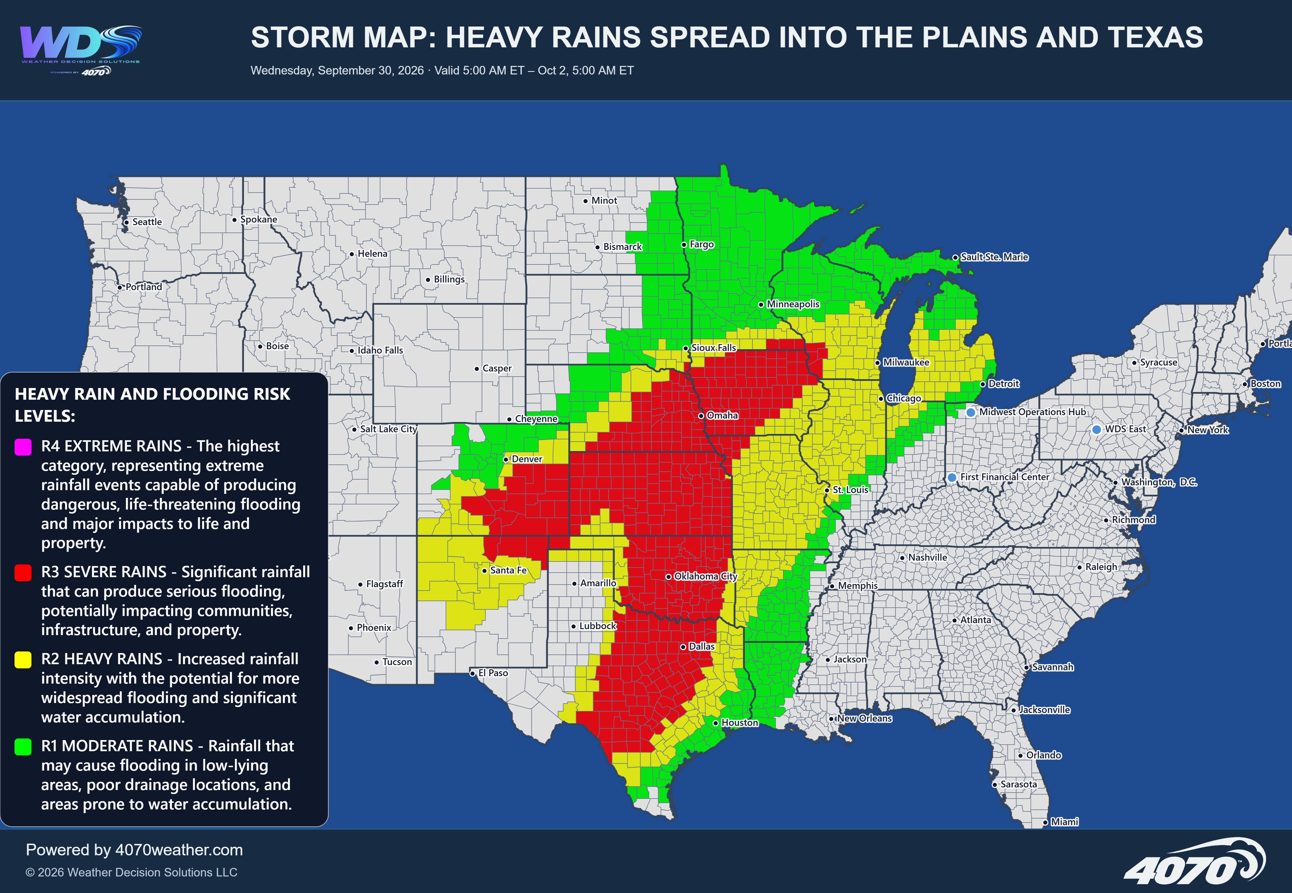

Major Storm System Threatens the Central United States Next Week
Forecast Period: Monday, November 2, through Wednesday, November 4, 2026
A significant storm system is expected to develop across the central United States early next week, potentially bringing a combination of heavy mountain snow, severe thunderstorms, damaging winds, large hail, and isolated tornadoes. The latest 4070 storm outlook indicates that this could become one of the more significant weather systems of the early November period, with impacts extending from the southern Plains into the Midwest and Mississippi Valley.
The developing storm will feature a strong area of low pressure moving across the central Plains, with a powerful cold front advancing eastward. This setup could create a substantial contrast between colder air behind the system and warmer, moisture-rich air ahead of it. That combination will help fuel a potentially volatile weather pattern.
Severe Weather: Southern and Central Plains into the MidwestThe greatest severe weather concern is expected to develop across a broad region extending from Texas and Oklahoma northward through Kansas, Missouri, Iowa, Nebraska, and portions of the Mississippi Valley.
As the storm strengthens, thunderstorms could develop along and ahead of the advancing cold front. The environment may become favorable for organized severe thunderstorms, including the potential for damaging straight-line winds, large hail, and tornadoes.
The threat area shown on the map is extensive, covering portions of the southern Plains and expanding northward toward the central Midwest. Areas around Dallas, Oklahoma City, Kansas City, Omaha, and St. Louis will need to be monitored closely as the system develops.
The exact placement of the strongest storms will depend on the storm track, frontal timing, and the amount of instability available. However, this is a setup that deserves close attention, particularly across the southern and central Plains, where severe thunderstorms could become organized and potentially produce significant impacts.
Heavy Snow: Rockies and Front RangeOn the colder side of the storm, snow is expected to develop across portions of the central and northern Rockies. The strongest snowfall potential is focused across the higher elevations of Colorado and surrounding mountain regions, with accumulating snow also possible along portions of the Front Range.
The map indicates a meaningful heavy-snow signal across the mountainous areas, with the potential for snow to extend eastward toward communities along the Front Range, including the Denver region.
Travel conditions could deteriorate across mountain passes, especially where heavier snowfall develops. Even areas closer to the Front Range could experience periods of accumulating snow as colder air moves into the region.
A Strong Temperature ContrastOne of the important features of this storm will be the sharp contrast in air masses. Colder air will push southward and eastward behind the developing system, while warmer and more humid air remains in place across the southern and central United States ahead of the front.
This contrast will help support the development of thunderstorms while also allowing snow to develop on the colder side of the storm. It is this combination that makes the system particularly important to watch.
Timing and What to WatchMonday and Tuesday appear to be the primary days for significant weather development, with the system expected to organize and move across the central United States.
The storm track and timing will be critical. Small changes in the position of the low-pressure center and cold front could shift the areas most likely to experience severe thunderstorms or accumulating snow.
As we get closer, we will be watching:
The development and strengthening of the central Plains low-pressure system.
The amount of warm, moist air available across Texas, Oklahoma, and the central Plains.
The potential for damaging winds, large hail, and tornadoes.
The placement and intensity of snowfall across the Rockies and Front Range.
The speed at which the cold front advances toward the Mississippi Valley and Midwest.
Next week's storm has the potential to become a major weather event across the central United States. Severe thunderstorms could develop across the southern and central Plains and spread toward the Mississippi Valley and Midwest, while heavy snow develops across the Rockies and potentially reaches the Front Range.
This remains a forecast that will require additional refinement, particularly regarding the exact placement and intensity of the severe weather. However, the overall pattern is concerning enough that residents, businesses, and emergency managers across the highlighted regions should begin monitoring the forecast closely.
The first week of November could get off to a very active start, with winter weather in the West and potentially significant severe weather farther east.
Daily Storm Reports are free public forecast discussions from the WDS ops desk.
For full forecast coverage, visit the 4070 weather platform, the forecasts page, or the storm report archive.