
STORM HITS THE PLAINS
Updated by Henry Margusity
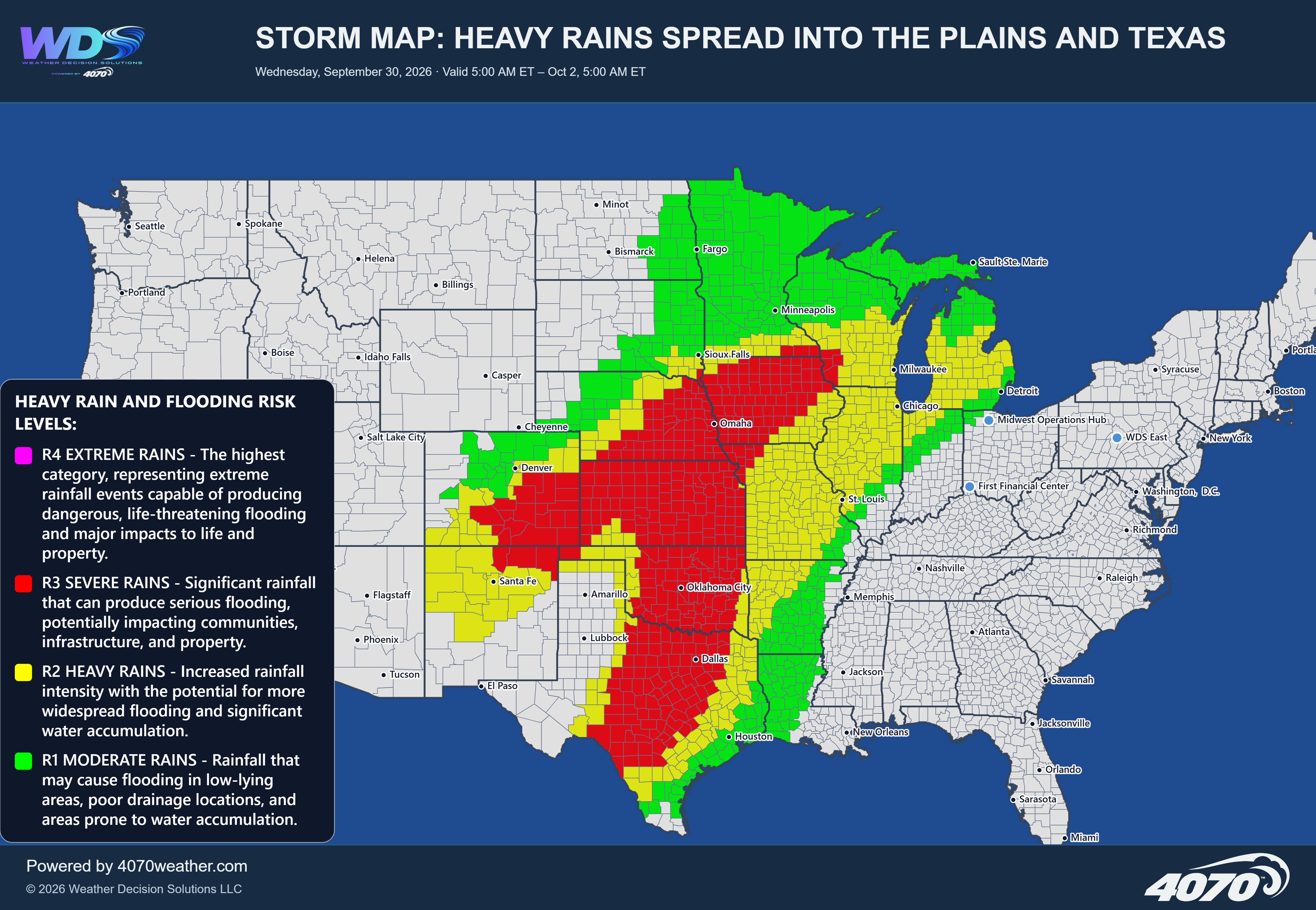

Storm Map: Major Storm Threatens the Central United States Next Week
Monday and Tuesday, November 2–3, 2026
A potentially significant storm system is expected to develop across the central United States early next week, bringing the threat of severe thunderstorms across the Plains and Mississippi Valley, along with accumulating snow across portions of the central and southern Rockies. The developing system could produce a wide range of weather hazards, from damaging thunderstorms in the warmer air to heavy snow on the colder side of the storm.
While the exact track and intensity will continue to evolve, the overall setup bears watching as we move toward the beginning of November.
Severe Storms Across the Plains and Mississippi ValleyThe greatest severe weather concern currently extends from Texas and Oklahoma northward through Kansas and Missouri, with the potential for storms to spread into portions of Arkansas, Louisiana, and the Mid-Mississippi Valley.
As low pressure develops and moves across the central United States, a strong frontal boundary will separate warmer, moisture-rich air to the east and south from colder air advancing southward behind the system. This contrast could provide the ingredients needed for strong to severe thunderstorms Monday and Tuesday.
Depending on the storm's eventual track, timing, and available atmospheric instability, thunderstorms could produce damaging wind gusts, large hail, and potentially tornadoes. Some storms may become intense, particularly where sufficient moisture, wind shear, and instability overlap.
The exact corridor of greatest risk remains uncertain at this range. Areas across Texas, Oklahoma, and the surrounding Plains should monitor forecast updates as the system comes into better focus.
Heavy Snow Across the Rockies and Front RangeOn the colder side of the storm, accumulating snow is possible across portions of Colorado, Wyoming, and nearby mountain areas. The map highlights a zone of potential heavy snow extending through the central Rockies, including areas near the Colorado Front Range.
Snowfall will be most favored at higher elevations, where colder temperatures and orographic lift can enhance precipitation. However, snow could also reach lower elevations along the Front Range, potentially affecting communities near Denver and surrounding areas if temperatures fall sufficiently.
Travel conditions could deteriorate in the mountains, particularly over higher mountain passes and exposed roadways. The eventual snow totals will depend on the storm track, temperature profile, and how much moisture reaches the colder air.
A Sharp Contrast Between Rain, Storms, and SnowThis system could produce a pronounced transition zone between severe thunderstorms and winter weather. The location of the surface low and trailing cold front will be especially important in determining where that boundary sets up.
Areas ahead of the front will have the better opportunity for thunderstorms, while locations behind the system will turn colder, with snow developing where temperatures and elevation support it. The transition zone may shift as the storm evolves, making precise local forecasts increasingly important as the event approaches.
What to Watch NextOver the coming days, the key forecasting questions will be the timing and strength of the low-pressure system, the amount of Gulf moisture returning northward, and the extent of colder air pushing into the Rockies and Plains.
These details will determine whether the severe weather threat becomes more organized and how far east the storm's impacts extend. They will also help clarify snowfall potential across the Colorado and Wyoming mountains and along the Front Range.
The Bottom LineEarly next week could bring a major, multi-hazard weather system to the central United States. Severe thunderstorms capable of producing damaging winds, hail, and isolated tornadoes will be possible across portions of the southern and central Plains into the Mississippi Valley. Meanwhile, accumulating snow could affect the central Rockies and portions of the Front Range.
This remains a forecast outlook rather than a final storm prediction, and the exact areas of greatest impact may change. Residents, travelers, and businesses across the highlighted regions should stay informed as confidence improves heading into Monday and Tuesday.
Daily Storm Reports are free public forecast discussions from the WDS ops desk.
For full forecast coverage, visit the 4070 weather platform, the forecasts page, or the storm report archive.