
STORM HITS THE PLAINS
Updated by Henry Margusity
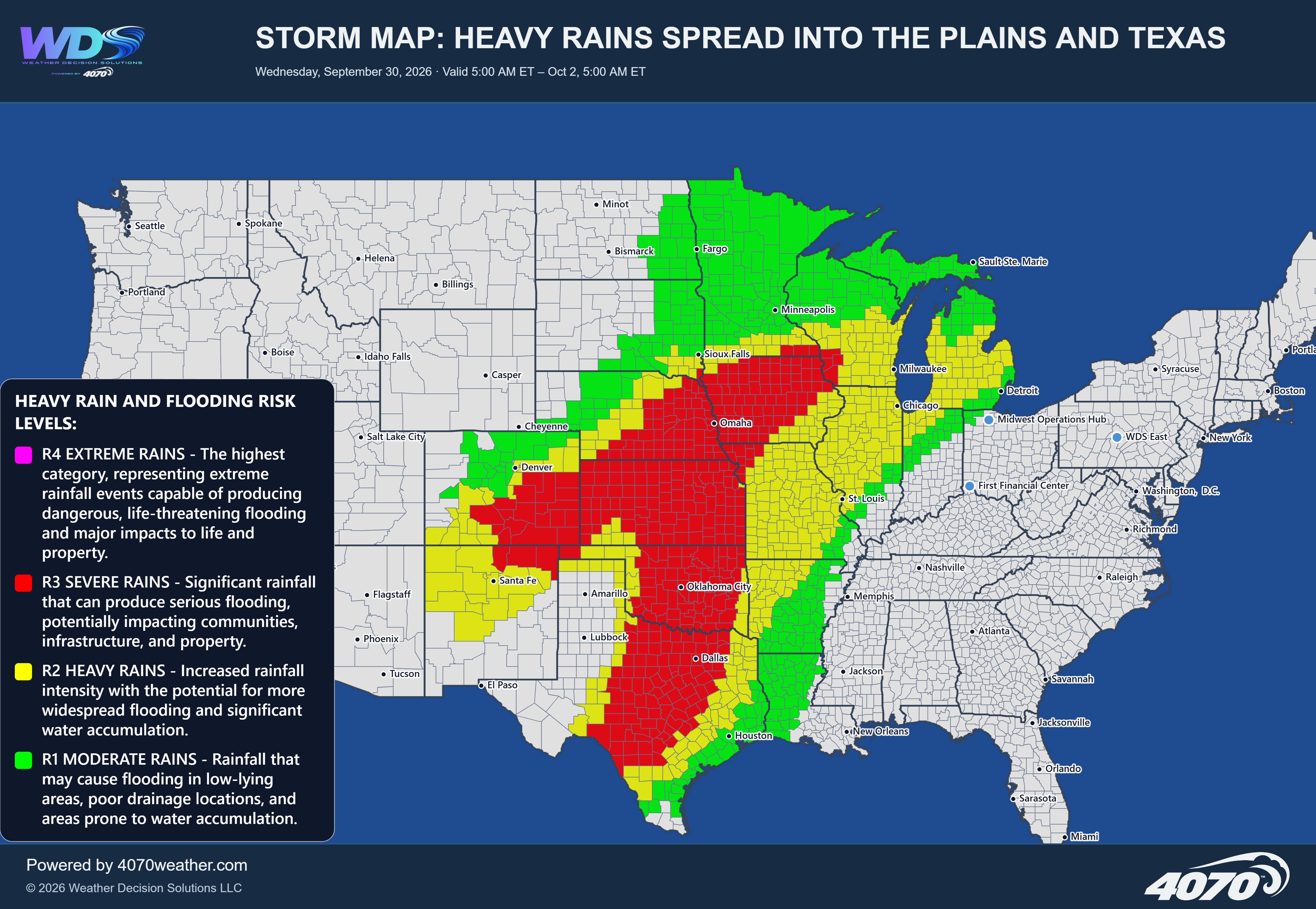

Storm Map: Major Storm System Brings Heavy Snow and Severe Weather – November 2–4, 2026
A powerful storm system is developing across the central United States, bringing the potential for significant winter weather across the Rocky Mountains and a widespread severe weather threat across the Plains and Mississippi Valley. This will be one of the more active weather systems of early November, with heavy mountain snow on the western side of the storm and the potential for damaging thunderstorms farther east.
The system is expected to strengthen as it moves through the central United States, creating a sharp contrast between colder air behind the storm and warm, moisture-rich air ahead of it. This combination will help fuel both the snowfall across the Rockies and the severe thunderstorms developing across the Plains.
Heavy Snow Across the Rocky MountainsOn the western side of the storm, colder air will move into the Rockies, producing periods of snow across portions of Idaho, Montana, Wyoming, Utah, and Colorado.
The heaviest snowfall will be focused over the higher elevations, where some locations could receive substantial accumulations. Snow will also extend toward the Colorado Front Range, meaning areas near and west of Denver could experience snowfall as the system progresses.
Mountain passes could become snow-covered, with reduced visibility and difficult travel conditions. The combination of colder temperatures and additional moisture will make this an important early-season snow event for the region.
Severe Weather: Texas and OklahomaThe greatest severe weather concern is developing across Texas and Oklahoma, where warm, humid air will interact with an advancing cold front and strengthening storm system.
Thunderstorms could become organized and intense, producing damaging wind gusts, large hail, and potentially tornadoes. The risk extends across much of Oklahoma and into northern, central, and eastern Texas.
The Dallas-Fort Worth region, Oklahoma City, and surrounding communities will need to closely monitor conditions as storms develop and move through the region. Some storms could intensify rapidly, creating dangerous conditions over a relatively short period.
Kansas, Nebraska, and MissouriThe severe weather threat extends northward through Kansas and Nebraska into portions of Missouri and the surrounding central Plains.
As the storm system strengthens, additional thunderstorms could develop along and ahead of the advancing cold front. Some of these storms may produce damaging winds, hail, and isolated tornadoes.
The storm track also places portions of the central Mississippi Valley at risk, with the potential for storms to continue developing as the system moves eastward.
Upper Midwest and Mississippi ValleyThe northern portion of the storm system will extend through parts of Nebraska, Iowa, and toward the Upper Midwest. Severe thunderstorms will be possible near the southern and eastern portions of this broader storm system, while areas farther north and west transition into colder and potentially wintry conditions.
This sharp contrast between warm-sector thunderstorms and colder air behind the system is typical of a powerful autumn storm system.
Storm Timing and ImpactsThe storm will affect a broad area from the Rockies into the central United States through Tuesday and early Wednesday.
Monday: Mountain snow develops across the Rockies, while severe thunderstorms develop across Texas, Oklahoma, and portions of the central Plains.
Monday night: Thunderstorms may continue and expand across portions of the central and eastern Plains and Mississippi Valley. The potential for damaging winds, hail, and tornadoes will need to be monitored.
Tuesday into early Wednesday: The storm system continues moving eastward, with additional precipitation possible along its track and colder air spreading behind the front.
This is a significant storm system for the first week of November. The western side of the storm will bring accumulating mountain snow, including the potential for substantial snowfall across the Rockies and portions of the Colorado Front Range.
Farther east, the atmosphere will become increasingly favorable for severe thunderstorms across Texas, Oklahoma, Kansas, Nebraska, and surrounding areas. Damaging winds, large hail, and tornadoes will all be possible.
The most important concern will be the potential for organized severe thunderstorms across the Southern and Central Plains. Residents across the higher-risk areas should remain weather-aware, have multiple ways to receive warnings, and be prepared to take shelter if severe weather develops.
Daily Storm Reports are free public forecast discussions from the WDS ops desk.
For full forecast coverage, visit the 4070 weather platform, the forecasts page, or the storm report archive.