THE FLOODING MAY BECOME THE ISSUE OVER THE NEXT TWO MONTHS
Updated by Henry Margusity
 WDSStorm.pngApr28.png
**A persistent and **stormy pattern** remains in place as a strengthening El Niño combines with a negative Arctic Oscillation. This setup is driving a steady stream of systems across the central United States, with little indication of a meaningful break in the pattern.
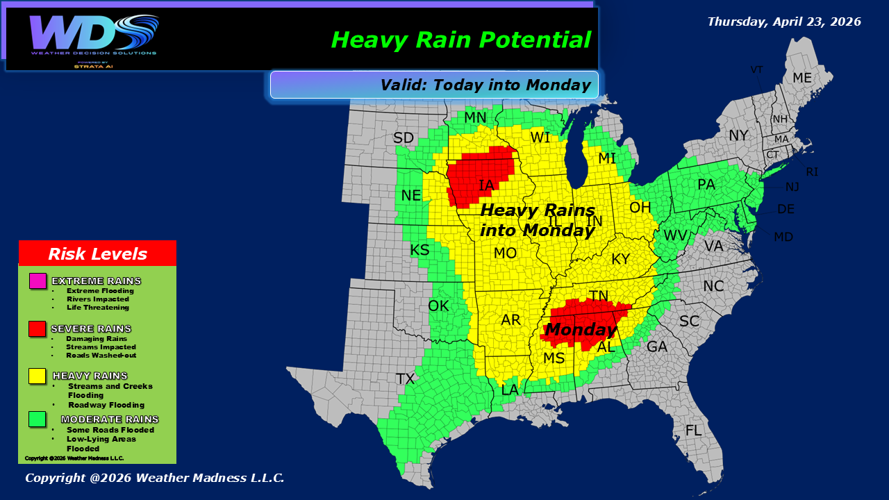
Over the next several days—and potentially extending into the coming months—these storms will bring **repeated rounds of heavy rain and severe weather**. The most immediate concern is the corridor from Missouri southward through Texas, Louisiana, Mississippi, and east into Georgia.
Thunderstorms in this region will be capable of producing:
- **Damaging wind gusts**
- **Large hail**
- **Isolated tornadoes**
- **Flash flooding** from heavy downpours
While severe weather will be an ongoing issue, the **bigger long-term concern is flooding**. With repeated rainfall events over the same areas, soils will become saturated and rivers will begin to rise, increasing the risk for **more significant and prolonged flooding problems** over time.
Looking ahead, any interaction with tropical moisture or a developing tropical system would only **enhance rainfall totals**, further increasing flood risks across the region.
 Severe Rainfall Map
**Bottom Line**
- Active storm track continues across the central and southern U.S.
- Severe storms producing wind, hail, and some tornadoes
- Heavy rain leading to **increasing flood concerns**
- Greatest impacts from MO → TX → Gulf Coast → GA
- Pattern remains **persistent and high-impact**
This is a **cumulative-impact pattern**, where repeated storms—not just one event—will drive the most significant weather issues moving forward.
Daily Storm Reports are free public forecast discussions from the WDS ops desk.
For full forecast coverage, visit the Strata Weather Portal, the forecasts page, or the storm report archive.